
Google Maps have created a way for people to navigate around the world through their smartphones. With the images of locations around the world, a lot of people rely on Google Maps in finding their ways or exploring new places. Unfortunately, there are still many places in the world left unmapped with Street View.
That is why Google Maps is opening its doors to users who want to contribute street view images. The Street View app on Android has a new update that will enable users to take photos using only their smartphones.
Before, you will need high-end equipment and sophisticated devices to take images and publish them on Street View. Now, all you need is your smartphone camera.
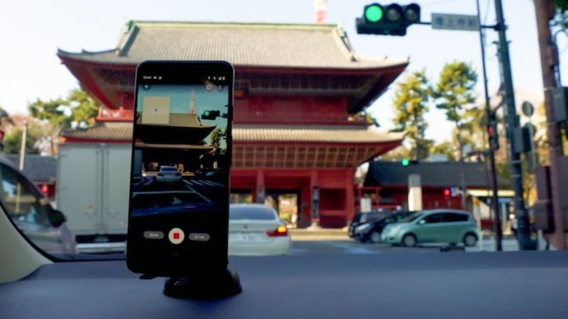
How to Capture Street View Photos Using a Smartphone


Credit: Google 
What You Need to Contribute to Street View Photos
While anyone can contribute to the Street View imagery, you will first need to have an ARCore supported device. An ARCore device means that it passed the certification that Google wants. ARCore is checking the quality of the smartphone, including its camera, architecture, motion sensors, and other features. It is to ensure that the devices used are within the desired requirements.
There are several Android and iOS devices that are ARCore supported, such as the iPhone 11, iPhone X, Samsung Galaxy S9, Galaxy S10, Sony Xperia, and more. However, the recent Street View app update is only available on Android.
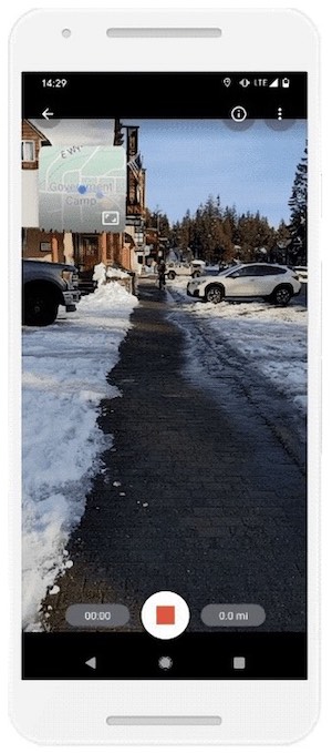
How to Create and Upload Images to Street View on Google Maps with your Phone


Credit: Google 
If your device is ARCore supported, you can start recording street view images of locations unmapped on Google Maps. You can also take photos of new businesses or addresses that need updating. After you recorded them, you can publish the images in the Street View app.
Submitted images will be edited and connected to create the right places on Google Maps. Connected photos appear in the Street View layer. You can see the dotted blue lines on Google Maps. To find these images, just drag the Pegman around.
With the updated street views, it is easier for other people to see and explore new locations. Google Maps make sure to establish privacy control when using the images. Users can also report imagery for review.
The new feature is available in selected locations like Austin, Texas, New York, New York, Toronto, Canada, Costa Rica, Indonesia, and Nigeria. It will be available in other regions soon.
What do you think of the new feature on Google Maps? Let us know your thoughts by leaving us a comment below.